


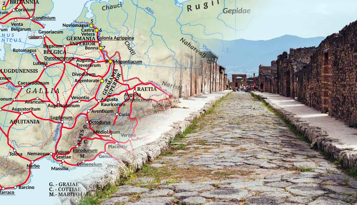
A new interactive map, itiner-e, is reshaping our understanding of the Roman Empire’s transport system. Researchers have revealed that the empire’s road network was about 60% larger than previously thought. The map is based on a combination of topography mapping, satellite imagery, and centuries of historical documents, making it the most detailed dataset of its kind.
The compilation shows nearly 300,000 kilometres of roads as they existed in AD 150, connecting millions of people across Europe, Africa, and Asia. Historians note that this network influenced trade, mass migration, the spread of early Christianity, and even pandemics across the continent.
Itiner-e is publicly available, allowing anyone to explore ancient routes, ports, and key cities. Beyond academic research, it provides a visual understanding of Roman logistics, infrastructure, and governance. The map highlights how the empire’s road and sea networks facilitated cultural exchange, economic growth, and political control over vast territories.
This innovative project underscores the complexity and reach of Roman engineering, offering new insights into how infrastructure shaped history.


Post a comment


You won’t believe these rare rice types actually exist!
A world of hidden flavours, ancient traditions, and rare grains-each with unique colours, textures, and...
From Tragedy to Tribute: Shalini Roberts’ Compassion!
After losing her father, Shalini Roberts turned her pain into purpose, founding the Roberts Trust...
Sarmoli’s 5-Day Sustainable Village Escape With Kids!
Stay in an eco-homestay, forest walk, farm day, weaving workshop and alpine birdwatching in Sarmoli...
The Hidden Cost of Credit Obsession at Work
Recognition is healthy, but this new trend is not. People at every level, from Interns...


