


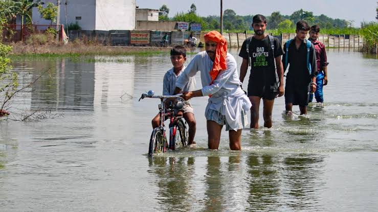
Punjab’s lush geography with the Ravi, Beas, Sutlej, and seasonal tributaries like the Ghaggar and choes makes it naturally prone to floods, especially during heavy upstream monsoon rains. Earthen embankments (dhussi bundhs) are intended to serve as barriers but often fail when rivers exceed capacity. In August 2025, inflows into the Beas reached 50,000–55,000 cusecs, and the Ravi surged following rainfall in Himachal Pradesh and J&K, inundating vast areas of Kapurthala, Tarn Taran, Ferozepur, Fazilka, and Hoshiarpur.
Flood risks are further amplified by human missteps. Major dams Bhakra on the Sutlej, Pong on the Beas, and Ranjit Sagar/Thein on the Ravi operate under rule-curve policies that prioritize irrigation and power use, often releasing water suddenly when reservoirs are full, triggering downstream flash floods. Embankments remain weak due to poor maintenance and illegal sand mining, while sedimentation reduces dam storage capacity. Governance gaps like weak coordination among dam authorities, delayed warnings, and a lack of flood-safe planning and infrastructure investments deeply exacerbate the situation.


Post a comment


Delhi Breathes Easier: Cleanest Air in Eight Years!
For Jan–Sept 2025, Delhi recorded its lowest average AQI since 2018 aided by better weather...
Kolkata’s air quality dips to ‘Poor’ ahead of Kali Puja—board...
Kolkata has slipped into the “Poor” air quality category in the run-up to Kali Puja,...
Fiery streak, Meteor showers over Delhi-NCR : Sky spectacle mystifies
At ~1:20 AM, residents across Delhi-NCR saw a bright, fiery streak. Speculation ranges from meteor...
Mizoram’s first rail line inaugurated : Bairabi-Sairang corridor!
PM Modi inaugurates the long-awaited 51.38 km Bairabi-Sairang railway line, linking Aizawl to Indian Railways...


